Rivers
As surface water moves over Florida's landscape, it drains into channels and forms a weblike network of nearly 1,700 rivers and streams that stretch across the state (Gazetteer of Florida Streams, 1966). Ranging from a few feet to a couple of miles wide, these freshwater veins carve into the limestone bedrock, shaping Florida's distinctive karst topography; they are the lifelines for many of the state's swamps, marshes, lagoons, and estuaries. Rivers and streams transport sediments and nutrients essential for wetland habitats and the native plants and animals that depend on them. Florida's rivers and streams also moderate the salinity of brackish environments and offer a warm winter refuge for migratory and local wildlife, such as the Florida manatee.
In addition to an assortment of commercial and agricultural uses such as avenues for barge traffic and water for irrigation, Florida's rivers offer water enthusiasts a wide spectrum of recreational activities such as swimming, fishing, boating and canoeing, scuba diving, fossil and artifact hunting, and wildlife observation. Millions of tourists and local residents are attracted to Florida's rivers each year. Hundreds of public riverside parks, boat ramps and piers are maintained by federal, state, district, county and city agencies; and by companies and homeowners' associations.
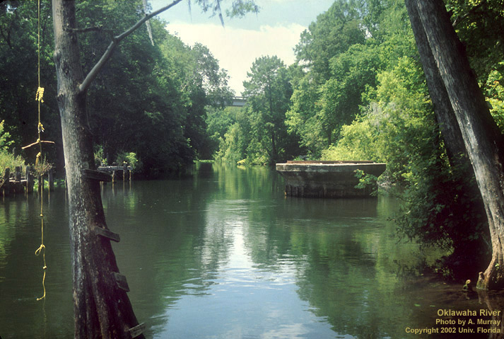
The Ocklawaha River is one of approximately 1,400 rivers and streams that cross Florida.
River Geology
Florida's geology gives each river unique collections of environmental characteristics (water quality, flow, clarity, temperature, and floral and faunal populations).
Geologists classify Florida's rivers into four categories
| Sand-bottom streams are the most common type in Florida. They are characterized by moderate to swift currents and slightly acidic water. | 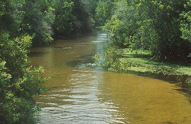 |
| Calcareous streams usually orginate from springs. They have relatively colder temperatures, and generally clear alkaline water that is easily penetrated by sunlight and is rich in calcium and nutrients such as phosphorus. As a result, calcareous streams have dense vegetation and diverse animal populations. |  |
| Larger rivers are characterized by their above-average size. As a result, large amounts of suspended silt and clay create turbid (cloudy) water. Because these rivers flow into the Gulf or the Atlantic, they are occupied by a mixture of freshwater and marine organisms. The largest rivers in Florida are the St.Johns River, the Choctawhatchee River, the Escambia River, and the Apalachicola River. | 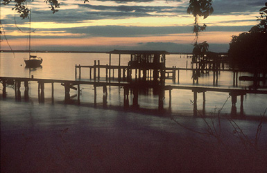 |
| Swamp and bog streams originate from the swamps, bogs and marshes commonly located in the coastal lowlands. Swamp and bog streams have slow currents. They have dark acidic water with a large amount of suspended organic matter and tannins. The brown or tea color results in the common name "blackwater river". The dark water limits light penetration and therefore reduces plant growth; reduced plant populations results in less diverse animal populations. | 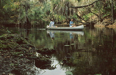 |
Some of Florida's rivers disappear underground and drain into a subterranean limestone labyrinth of aquatic caves. The notable Santa Fe River disappears underground at O'Leno State Park and reemerges at River Rise Preserve State Park, 3 miles away. Visitors at Falmouth Springs can watch groundwater emerge from a spring to create a short river that siphons underground, a mere 500 feet away.
Factors Influencing Plant Growth in Florida Rivers
As with lakes, the morphometry and chemical composition of Florida rivers influence their capacity to support native aquatic plants and their susceptibility to invasive plant problems. Vegetation in Florida’s rivers is affected by pollution, physical alterations, invasive species, drought and groundwater depletion, and unmanaged recreational activities.
Most of the rivers in central and south Florida are slow-flowing as they cross the flat prairies. For example, the St. Johns River is more than 300 miles long yet drops less than 30 feet in elevation from the headwaters in Indian River County north to the Atlantic Ocean in Duval County. During the dry season, wind conditions can reverse the flow of the St. Johns. This slow flow combined with wide, shallow depressions along the river course make ideal conditions for floating plants such as water hyacinth and water lettuce to flourish. In contrast, most rivers in north Florida are fast-flowing, leaving little time for floating plants to establish.
As with lakes, water depths and light penetration play fundamental roles in the presence and abundance of rooted vegetation, especially submersed plants, in Florida rivers. Some rivers may completely dry periodically (e.g. the Alapaha River, Hamilton Co.) while others may be too deep for light to penetrate to the bottom. Like lakes, light is blocked by tannins from adjacent swamps or turbidity from upstream erosion. Light may also be reduced by shade from dense tree canopy over the stream. Nutrients derived naturally from the sediments, as well as those flushed from surrounding urban or agricultural lands or entering from the groundwater, all contribute to aquatic plant growth in Florida rivers. Physical alteration including filling adjacent wetlands, cutting trees, constructing bulkheads, and straightening or dredging deeper channels all influence aquatic plant growth in Florida rivers.
Springs and Spring Runs
Springs represent major discharge areas, where groundwater is forced to the surface due to pressure from confining beds of impermeable sediments. Releasing eight billion gallons of fresh water each day, Florida has the most productive spring system in the world. Over 600 springs have been documented and geologists estimate that hundreds more are waiting to be discovered. The majority of Florida’s springs are found in central and north-central Florida—part of the Floridan aquifer system, one of five main aquifers in the state. These underground aquifers are the reservoirs for Florida's natural water filtration systems providing most of the state's drinking water and more than half of the state's freshwater usage in agriculture and industry. Groundwater released from aquifers, either through springs or constructed wells and pumping stations, sustains thousands of ecosystems and is an essential resource for human health, outdoor recreation, industry and agriculture.
Florida is home to more large (first and second magnitude) springs than any other state in the nation. Some spring runs support entire ecosystems with unique plants and animals. Springs also flow into other rivers that are dependent on this source of clean fresh water. Additionally, Florida’s springs offer many recreational opportunities such as swimming, kayaking and diving, attracting visitors from all over the world and serving as economic drivers for many communities.
Florida's springs face various complex threats, including decreasing water flows and excessive nutrients. Spring flows decrease because of declining water levels in the groundwater aquifer that sustain them. Excessive nutrients, mainly nitrate, can lead to algal growth and habit degradation. Florida is committed to investing in nitrate-reducing capital projects (wastewater, stormwater and non-point source pollution control projects) as well as acquiring and conserving land in spring recharge zones to prevent nitrate contamination.
Special Plant Management Considerations for Rivers and Spring Runs
Rivers and spring runs present managers with additional challenges above those faced in lakes and reservoirs. Mechanical control may be difficult due to few access points to launch machinery and suitable disposal sites for harvested material. High stream flow can make it difficult to sustain herbicide concentrations in a specific area long enough to control submersed plants.
Floating plants must be managed at low levels along river channels. As plant numbers expand, they are easily swept downstream to form mats at bends and other restrictions, or jam against bridges and flood control structures. Submersed and emergent plants may be pulled from the river bottom during storm events and form mats downstream.
Tropical storm Allison in 1992 dislodged hundreds of acres of floating plants and hydrilla from several of the St. Johns River headwater lakes. Masses of hydrilla and floating plants were carried downstream and jammed against the U.S. Highway 192 bridge. Plants were compressed into a tight mass by the force of the river and completely filled the water column in about nine feet of water, pushing against the bridge. Water channeled through the few remaining openings, accelerating flow and scouring the footings of bridge pilings. Mechanical harvesters and divers with hydro-saws had to be dispatched immediately to save the bridge from damage.
Similar situations have occurred on the Withlacoochee (1981 and 1986) and Myakka (1991) Rivers where hydrilla was uprooted during storms and compacted against downstream bridges. Bridges are not designed to withstand the prolonged lateral stresses and scouring caused by debris pushing against the structures. Therefore, managers attempt to avoid these conditions through frequent maintenance control of upstream invasive plants and tussocks.
Water quality in rivers can quickly change during storm events. For example, the state standard for dissolved oxygen (DO) in Florida waters is 5.0 ppm. DO levels in the slow-flowing Withlacoochee River are historically very low during hot summer months. Summer thunderstorms routinely generate high amounts of rainfall that flush organic material and water that is already oxygen-depleted from surrounding swamps into the river channel. This further reduces DO levels, often below 2.0 ppm, resulting in stressed fish or fish kills. Managers are reluctant to control plants in the summer months to avoid additional DO stresses; therefore, work to keep water hyacinth at the lowest feasible levels during cooler months is essential.


